CASTLE, CASTLE, CLIFFS - Day 11 - October 11, 2023
The sun looked like it was going to come out this morning as we left our luxurious castle on the lake (Lough Eske) and drove the short distance into Donegal Town. This is where another castle, Donegal Castle, sits on the banks of the River Eske.
The castle site dates back to the 10th century, when Vikings roamed the area. The present structure is a combination of construction from the 15th century and the 18th century. We took a self-guided tour of this interesting piece of Irish history.


Then, we had a short stroll through the quaint downtown. There is no shortage of pubs in any of the towns we’ve been through, regardless of size. Below is an example of one in Donegal, along with a photo of a distant relative of the owner?


Afterward, we hopped into the car and drove directly west on portions of the Wild Atlantic Way (a network of scenic roads that run along the west and north coasts) toward Sliabh Liag out on the Donegal Peninsula.
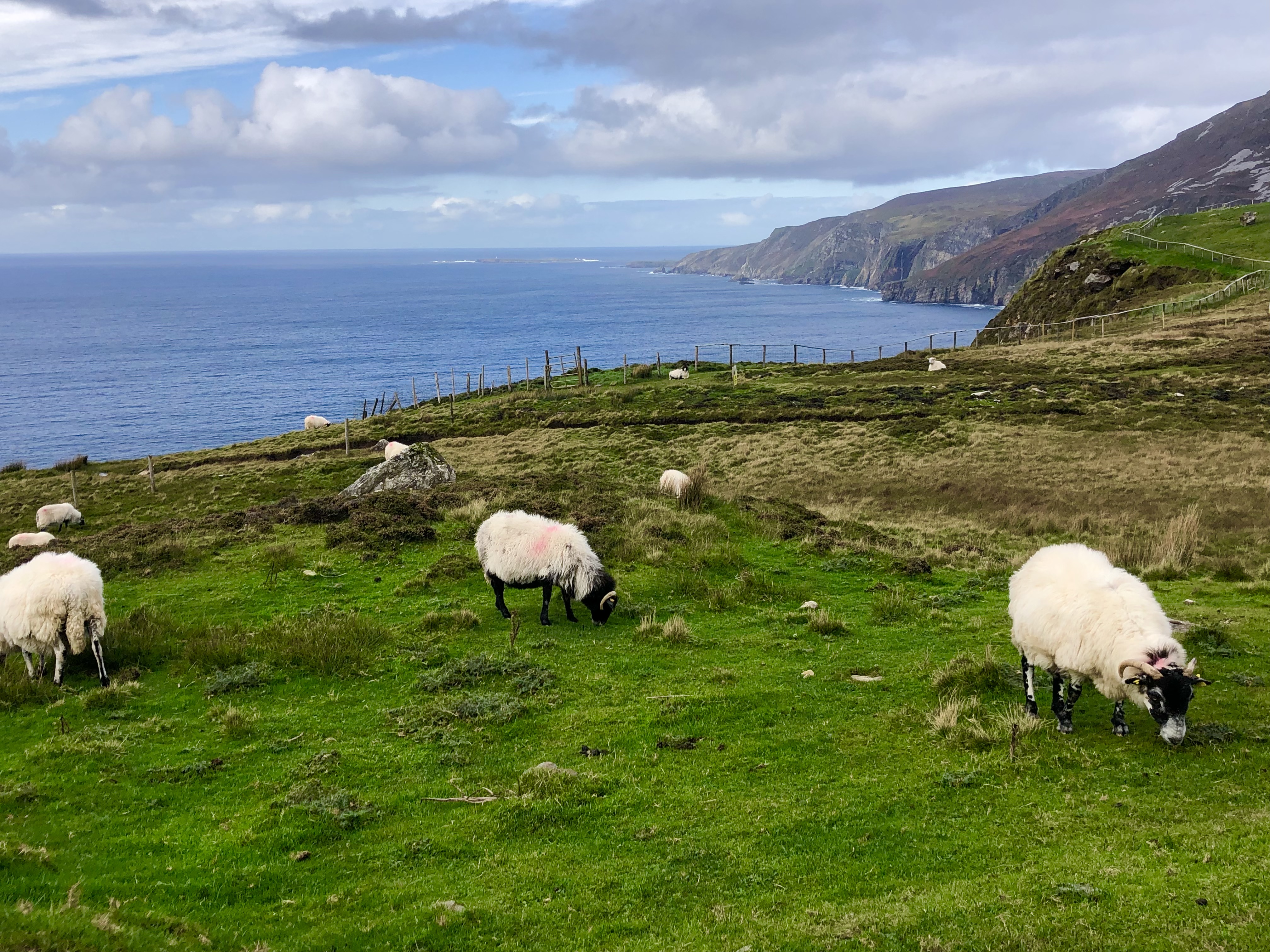
The sun came out as we got closer to the coast. The wind was brisk and the clouds were starting to clear when we began our 45 minute walk from the car park to the viewing area for the spectacular cliffs of Sliabh Liag (Slieve League).

As usual, sheep seemed to have control of the area. They were grazing all over the steep cliffs. We didn’t get as close to the edge as they did, but we got some exhilarating views.


One interesting (and, relatively recent) historical artifact is still in place along these cliffs. During WWII, Ireland was a neutral country, so it placed stone markers along its coast in several locations in the country to warn approaching pilots that they were entering Irish airspace. One of these signs is still visible from the road leading up to the cliffs. You can see the letters, EIRE, below.

After our invigorating walk, we drove northeast toward Portrush, Northern Ireland. The countryside became more wooded and hilly as we went up toward the north coast through Barnesmore Gap.
We saw many areas of Sitka Spruce forests on this route (as we have on most of our drives this trip). They are planted as a commercial crop by private farmers and by a semi-governmental organization. Some information I saw indicates that Ireland, at one time, was covered with 80 percent forestland. By the 1920’s, most trees had been cut to clear the land for farming. Since then, there’s been a concerted effort to restore trees. So far, just over 10 percent of the country is considered forest.
We got to Portrush late in the afternoon. On the road, we entered the United Kingdom, where our Euros are no longer accepted, the signs are all now in English, and distance and speed are measured in miles.

NEXT: Giant’s Causeway and Rope Bridge
Wonderful pictures to accompany your travel story.Thanks
ReplyDelete