We got to the motel restaurant for breakfast by 7:00am, picked up our box lunch (the motel gave us a lunch because they forgot to give us the AAA discount on the room rate), packed our bags and hit the road by 8:30am. Our mission was to see everything we could see before it got dark.
The West Entrance road follows the Madison River and Gibbon River. Our first stop was for some photos at Gibbon Falls.

Next was Artists Paint Pots, which feature colorful boiling mud pots.


Not far north from there, we visited the Norris Geyser Basin. This is the home to Steamboat Geyser, which is billed as the ‘World’s Tallest Active Geyser’. Since the geyser is actually on the ground, the ‘Tallest’ descriptor refers to how high into the air it spews scalding water. In this case, it is known to go more than 300’ high. It is also known for its unpredictable and infrequent major eruptions (of the 300’ variety). It more commonly goes 10’ to 40’.
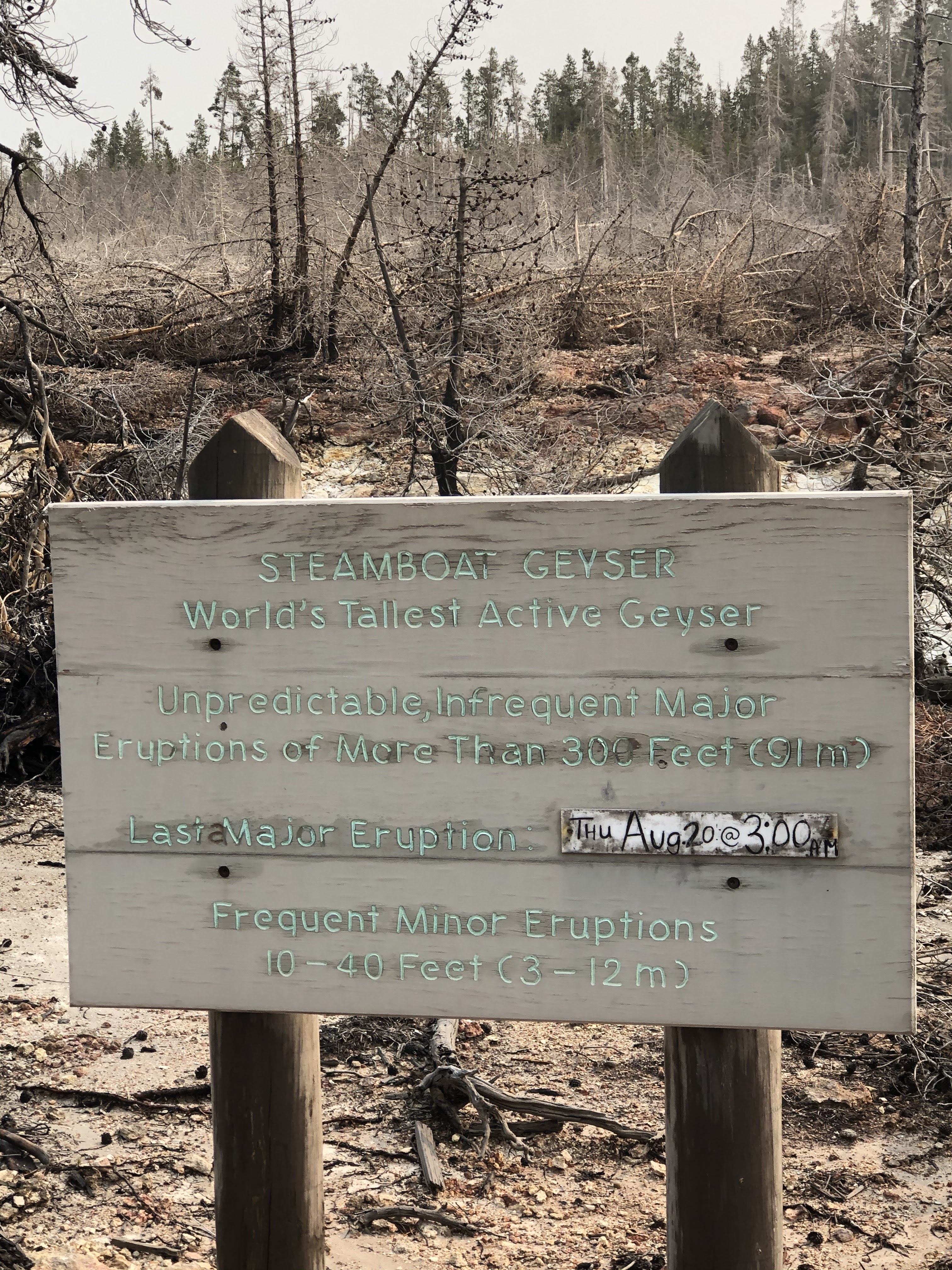
As luck would have it, Steamboat had a major eruption earlier this morning at 3:00am. When we arrived, it was still shooting water 50’ or more into the air, and the steam plume went even further. In many ways, it was more spectacular than Old Faithful: it went higher, it went longer, and we were much closer to it. The ranger told us it would go for more than 24 hours after a major eruption.


Still giddy from excitement (or, was it the sulphurous fumes we inhaled?), we continued north to Mammoth Hot Springs. We took the upper springs road and snapped some photos of the travertine terraces.


Our plan was to use the Tower-to-Canyon road to complete a circle and end up at the Grand Canyon of the Yellowstone. We discovered, however, that the road was closed for the year. Instead, we continued east into the Lamar Valley. Since our car got washed last night by a rain storm, it was time to get it dirty again. So, we took a six mile dirt road detour through the Blacktail Plateau, where we saw some great wildflowers and lush shady glens.

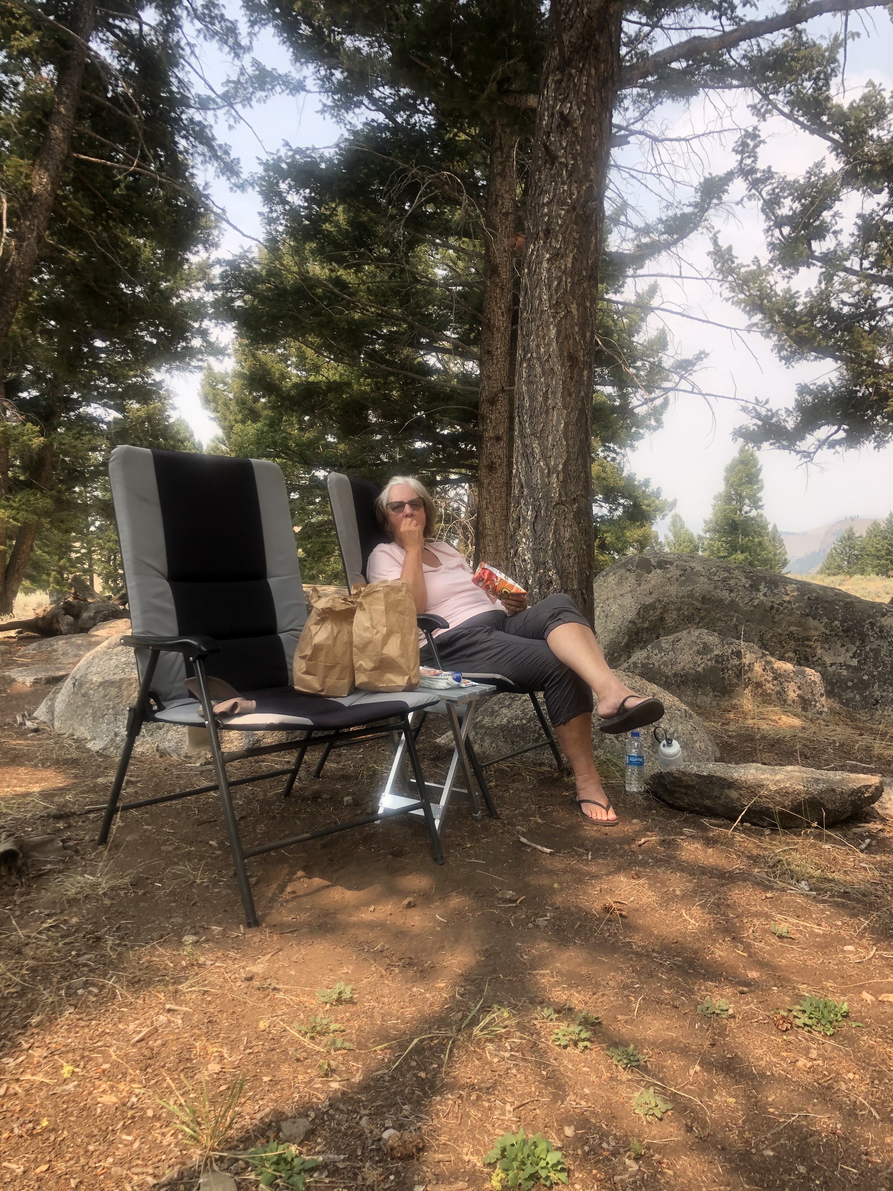
We found a spot behind some high cliffs above the Yellowstone River and ate our picnic lunch.

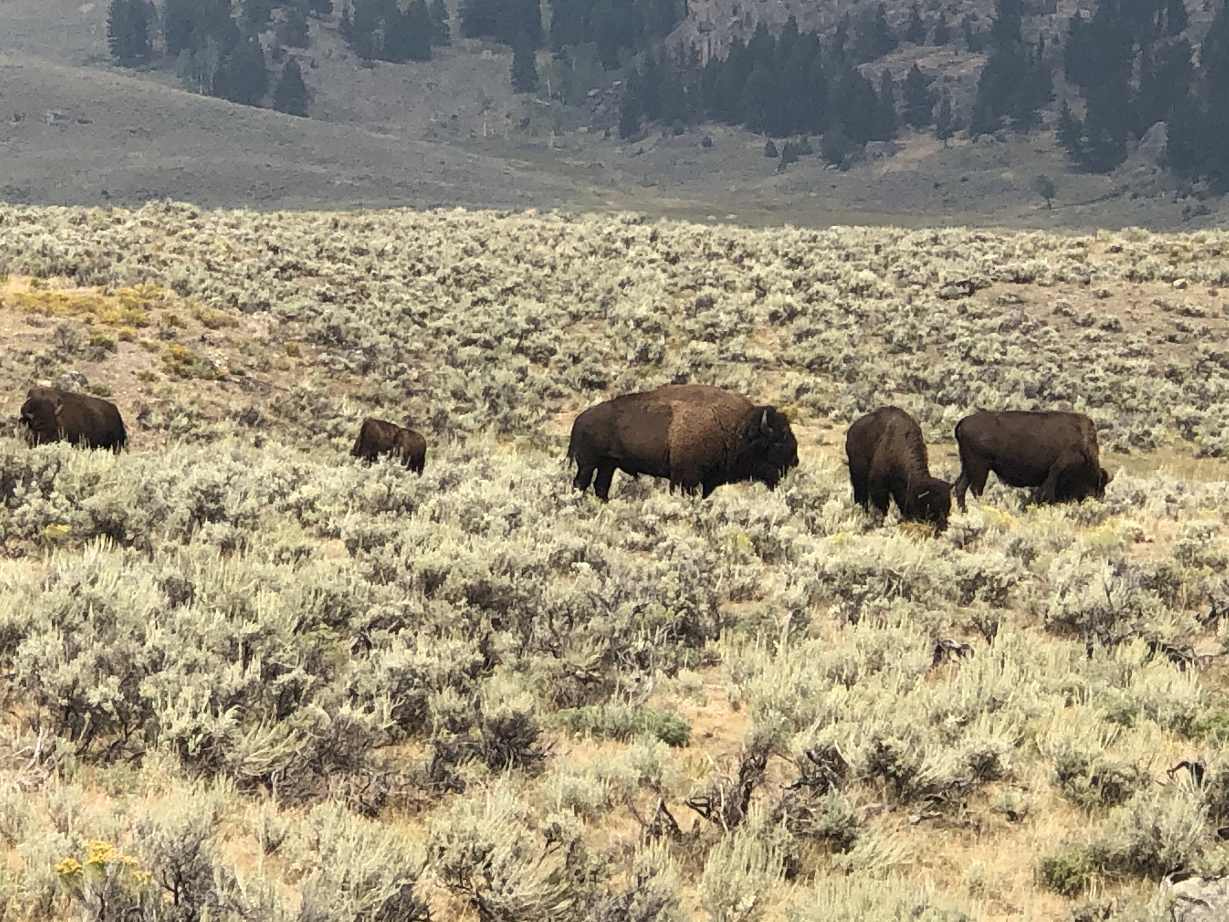
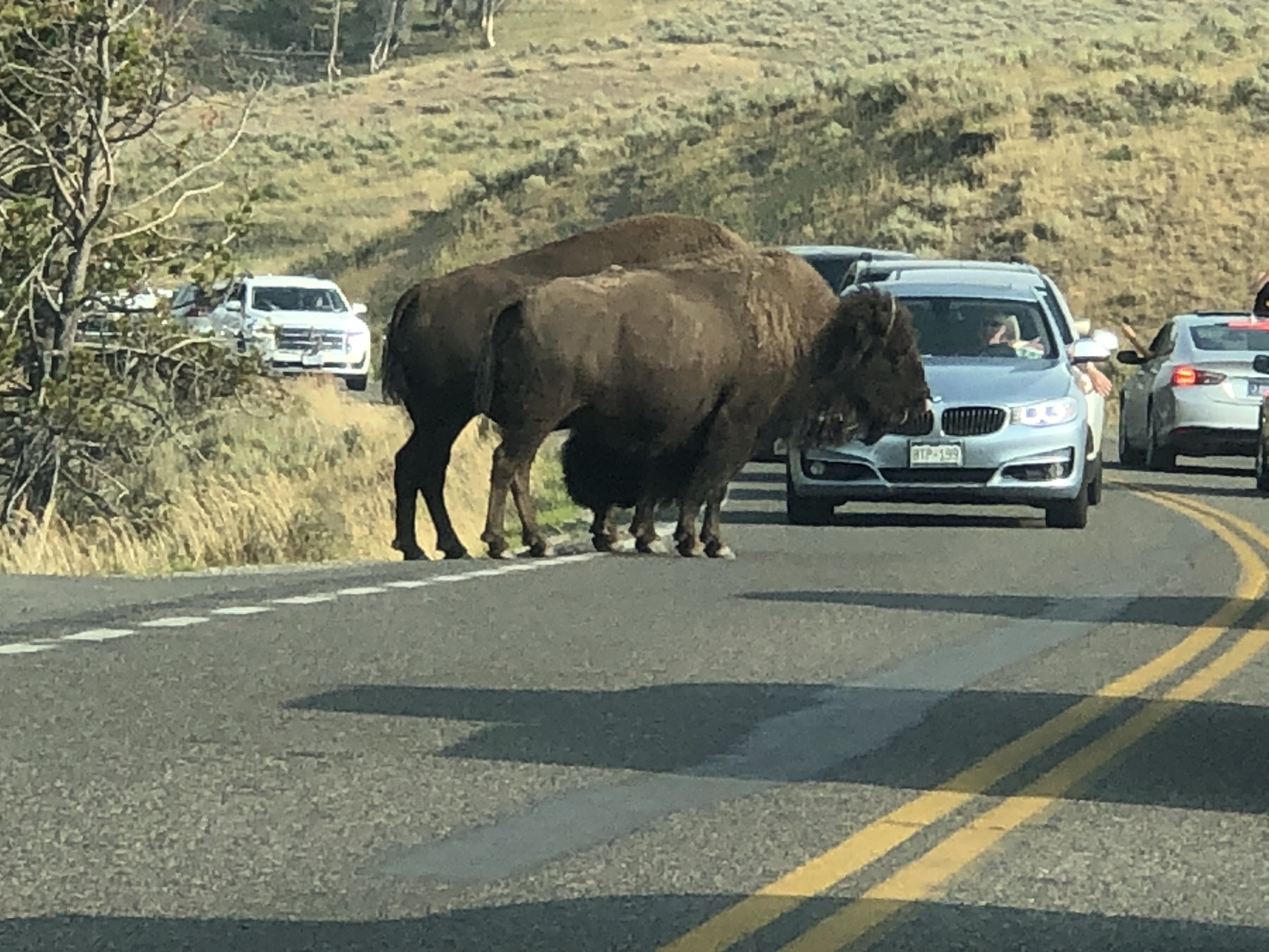
Then we visited with some buffalo along the road.
To get to the Canyon, we had to backtrack to the Norris Geyser Basin intersection, and then take the road east to Canyon Village. The views from both the north and south rims (and the waterfalls) were worth the long drive to get there.


Our drive out of the park to the East Entrance began by following the Yellowstone River south through the broad Hayden Valley. The river here is wide and placid, compared to what it looks like as it powers through the narrow canyon to the north.
Just as we got into the Hayden Valley, traffic came to a standstill. Up ahead, a herd of buffalo were walking and running down to the banks of the river to drink and bathe.
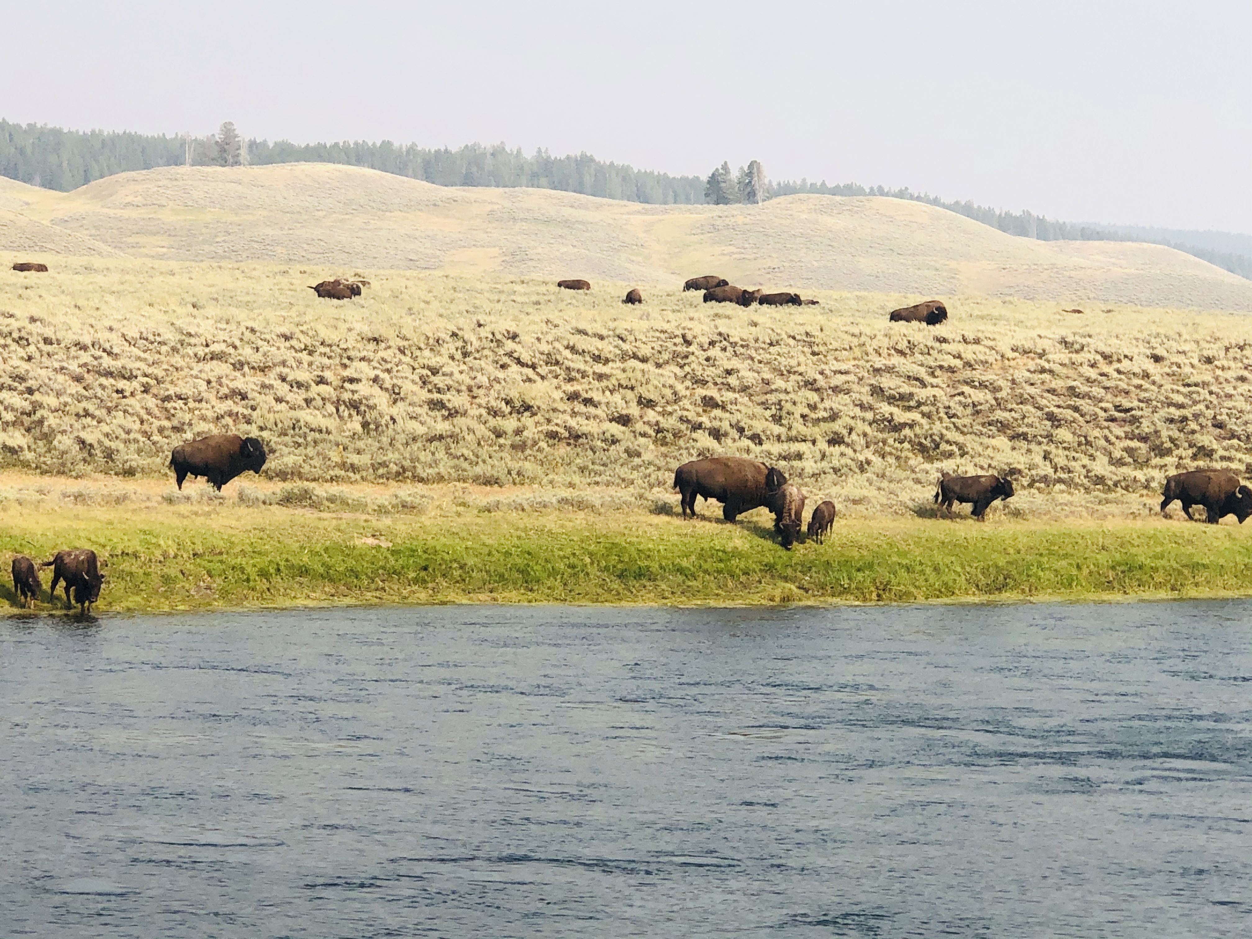
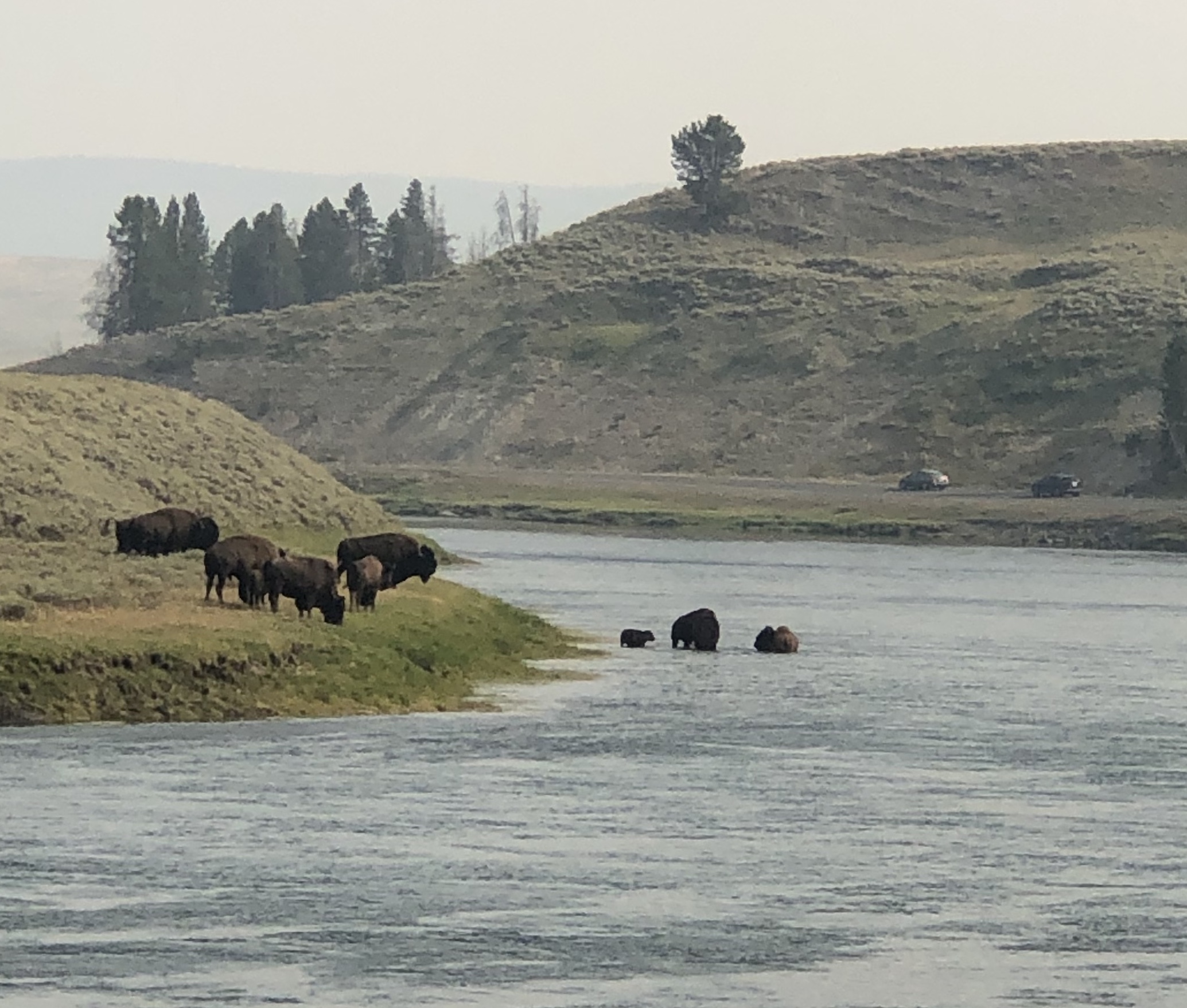
A little further down the road, traffic stopped again. This time a large herd of buffalo was crossing from one side of the road to the other. After many miles of seeing very little wildlife, the buffalo were suddenly as plentiful as pigeons!


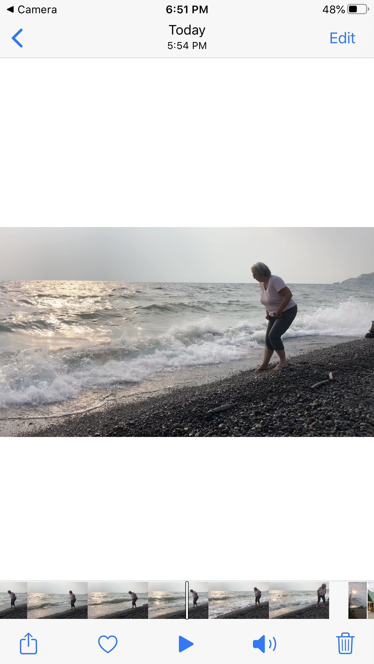
When the road turned east at Fishing Bridge, we followed the northeastern banks of Yellowstone Lake at just under 8000’ elevation. This is a big lake. The afternoon wind was blowing strong and there were whitecaps out on the water. We pulled over on a rocky beach and watched the waves crashing onto the shore as the sun began to set.


After dropping down a very steep and winding road to the Eastern Entrance, we reached our cabin at the Pahaska Teepee – more on that later. In the meantime, we’re resting from our nearly eleven hour day in the car. There’s no cell service or internet here, so this update will get uploaded the next time we’re near a city.
Next: Sundance (WY)
No comments:
Post a Comment