Wednesday, October 6, 2021

DAY 5 - More Rain Forest, Falling Rain, Falling Water, Falling Leaves, and Some Fungal Fun Walks

 The photo below shows what it feels like up here with no cell service - kinda like walking up to a phone booth (remember those?) and getting that empty feeling…


Our first night at the historic Lake Quinault Lodge was quite restful. The lodge has been on this site since the late 19th century and the current building dates from 1926. With the vintage steam radiators clanging and banging faintly in the background, and Karen’s soft snoring providing a musical counterpoint, it was easy to drift into dreams of woodland wonders.


Today brought us what we expected from a trip to the northwest: rain. The morning was overcast, wet and cool when I went out for a short walk along the lakefront. The temperature was in the low 40’s and it felt colder than that. The autumn leaves were drifting by the windows, the autumn leaves of red and gold.🎶


Speaking of leaves and trees, our first trip of the day was a mile down the road to see the ‘World’s Largest Sitka Spruce Tree’! While I was craning my neck upward to take in the majestic height of this arboreal giant, Karen was talking with a couple of hikers who had wandered up behind us. It turns out they were taking basically the same route as us around Olympic National Park. Their labrador retriever is a trained ‘truffle sniffer’ and they go around hunting for mushrooms during their travels. They showed us photographs of some ‘shrooms they’d found under some cedar trees and had eaten for dinner just the other night.


Back in the car, we decided to drive completely around Lake Quinault and take in some short hikes along the way. There are several waterfalls along the route, including Merriman Falls, Bunch Falls, and Cascade Falls. The road around the lake is paved for part of the way, and the remainder is a dirt (mud) and gravel road. In some respects, it’s like a cold weather ‘Road to Hana’, with waterfalls and thick rainforest flora lining the winding highway.


On the north side of the lake there is an old homestead (the Kestner Homestead) at the end of a lush nature trail.  All that remains of it are a few outbuildings and the rusting hulk of an old moving van.


Late in the afternoon we had a short hail storm, followed by some bright sunshine and a Hawaiian-style rainbow.


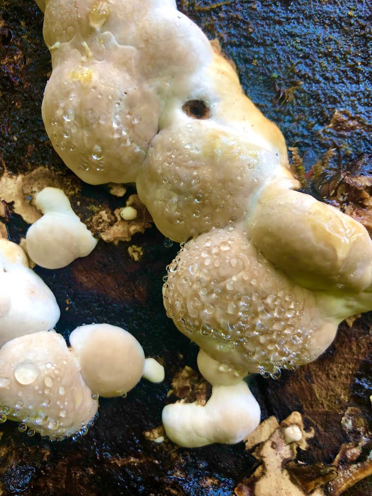
Then, we took one last hike up to a waterfall on a trail lined with all manner of fungus growing on the rotting fallen logs that littered the forest floor.




There are not a lot of dining options around here, but Karen found a local place in the nearby town of Amanda Park. Dino’s Diner is the local pizza place, but it also serves up a delightful menu of down-home comfort food. Karen had deep-fried prawns with mashed potatoes and country-style gravy. I had some pizza with a couple of pints of  ‘Irish Death Stout’ to wash it down. Just as we were finishing up, the local junior high school soccer club came bounding in for some post-game refreshments and the energy level in Dino’s went up to ‘high’.


There’s still no reliable cell or wi-fi service, so we’ll just have to wait until later to post our updates.


NEXT: We go east for the beginning of our Cascades National Park loop.

DAY 4 - No Cream in Crescent Coffee = Cranky Start, Turbulent Shores, Rainforests and Twilight Time - October 4, 2021

 Karen made her morning coffee in the room and then discovered there was no cream available. Our room was far enough from the main lodge (and with no in-room telephone and no cell service there was no quick way to contact the lodge) that she decided to go without the cream. We were in a hurry to check out of our room and when the desk clerk learned of the cream situation, she ‘cheerfully’ said she’d have made some available at the desk if Karen had only walked down there! As consolation, Karen got some free coffee from the main lobby. We decided that we won’t let that happen again. 


After a quick stop for donuts and yogurt at a little store in Beaver, we drove west until we reached the place where the Quillayute River empties into the Pacific Ocean. We visited both Rialto Beach and La Push First Beach.


Rialto Beach features  giant piles of driftwood and a rugged cobblestone beach with crashing waves. We tried to hike north to some sea stacks and arches, but the tide was rising quickly and there’s no safe way to traverse the beach when this is happening.


La Push is also a rugged beach, but it is partially protected by a small harbor. It is part of the Quileute Indian Reservation. We ate a snack here, surrounded by lurking hungry seagulls, and then hit the road back eastward toward Forks.


A couple of days ago, we were in a little town that inspired a book and a series of movies from the 1940’s. Today, we went through the little town of Forks, which inspired books and movies from the early 21st century. It turns out that the author, Stephenie Meyer, of the popular ‘Twilight’ stories used this mysterious part of northwest Washington as the setting for her tales of the undead. 


Highway 101 goes south from Forks to the junction of Upper Hoh Road, which goes to the Hoh Rain Forest Ranger Station. Hoh is a Native American word meaning ‘fast moving water’. The road follows the Hoh River for 19 miles up into the rain forest.


At just over 500 feet elevation, the Hoh Rain Forest is a wonderland of ferns, fungus, hanging moss, and gigantic maple, spruce and hemlock trees. Karen made us some sandwiches to eat at the ranger station, and then we started off on a hike into the forest.


The trail was rocky, slick and covered with large exposed tree roots. Even though we had an unusually sunny day, the trees still managed to capture whatever moisture was in the air, so the ground under the tree canopy remained wet. After a couple of miles, Karen gave me the green light to continue hiking while she returned to the parking lot.


My plan was to get to Mineral Springs Falls, which was just under 3 miles from the trailhead, and then circle back to hike the Hall of Moss loop and join up with Karen again. It was about 3:15pm when I took off.


The combination of the rough terrain, my penchant for stopping to take photographs, and the slippery climb up to the base of the waterfall caused me to take longer than I expected. By the time I got back to Karen it was 5:00pm and it was getting dark in the rain forest. 


We still had over an hour’s drive to our next stop, Lake Quinault, so we jumped in the car and continued south on Highway 101. Along the way we passed some spectacular views of the Pacific Ocean before we turned eastward through the Quinault Indian Reservation. 


Just as it got dark, we pulled into the historic Lake Quinault Lodge on the southern shore of Lake Quinault. Our room is in the main lodge. Just downstairs from us is the rustic lobby and its large fireplace with tall windows facing the lakefront.


We were both tired and hungry and ready to have some dinner in the Roosevelt (as in FDR) Dining room. However, due to a staff shortage, we had to order take-out from the restaurant and then bring it into the dining room/lobby to eat. I brought a bottle of Finnriver Cider in from the car and we had our dinner, then went upstairs for the evening.


As I’m typing these notes, Karen is softly slumbering after spending a vigorous day on the beach and in the forest. 


There is no cell service here and the wi-fi looks doubtful. We’ll try to get into the nearby town of Amanda Parks for a better signal sometime tomorrow. Otherwise, we’ll have to wait until we get back to civilization to upload our posts. Until then, here’s to living the rustic life!


NEXT: Exploring Lake Quinault and vicinity

DAY 3 - Ludlow Falls, Hurricane Ridge, Marymere Falls - October 3, 2021

Just a mile from our Port Ludlow lodge is the trailhead to Ludlow Falls. This easy path comes in just under a mile long and winds through some lovely stands of cedar, elm, and maple trees, many of which are covered in licorice ferns. Old logging railroad detritus can also be found along the trail. The falls is really a cascade, but it is very photogenic. Our pre-breakfast hike on this trail got us ready to hit the road.


Since we were going northward, we had to stop again at the Spruce Goose Cafe to have another airfield diner breakfast. Then, it was off to Port Angeles.


Highway 101 is the road that encircles Olympic National Park. Today’s trip took us along the northern section of the Olympic Peninsula through towns like Discovery Bay, Gardiner and Sequim. This area seems pretty heavily populated and the road had its share of retail shopping centers and small housing subdivisions. 


Once we got to Port Angeles we turned south for a few miles until we came to the Olympic National Park Visitor Center. After a quick discussion with the park ranger, we continued south up into the mountains on a 17 mile drive along the Klahhane Ridge toward the Hurricane Ridge Visitor Center.


At the beginning of our drive we were very close to sea level. The temperature was in the high 40’s F. and the sky was cloudy. As we climbed in elevation we quickly entered a thick and drizzly cloud bank that kept us in very low visibility conditions for most of the remainder of our drive up the mountain.


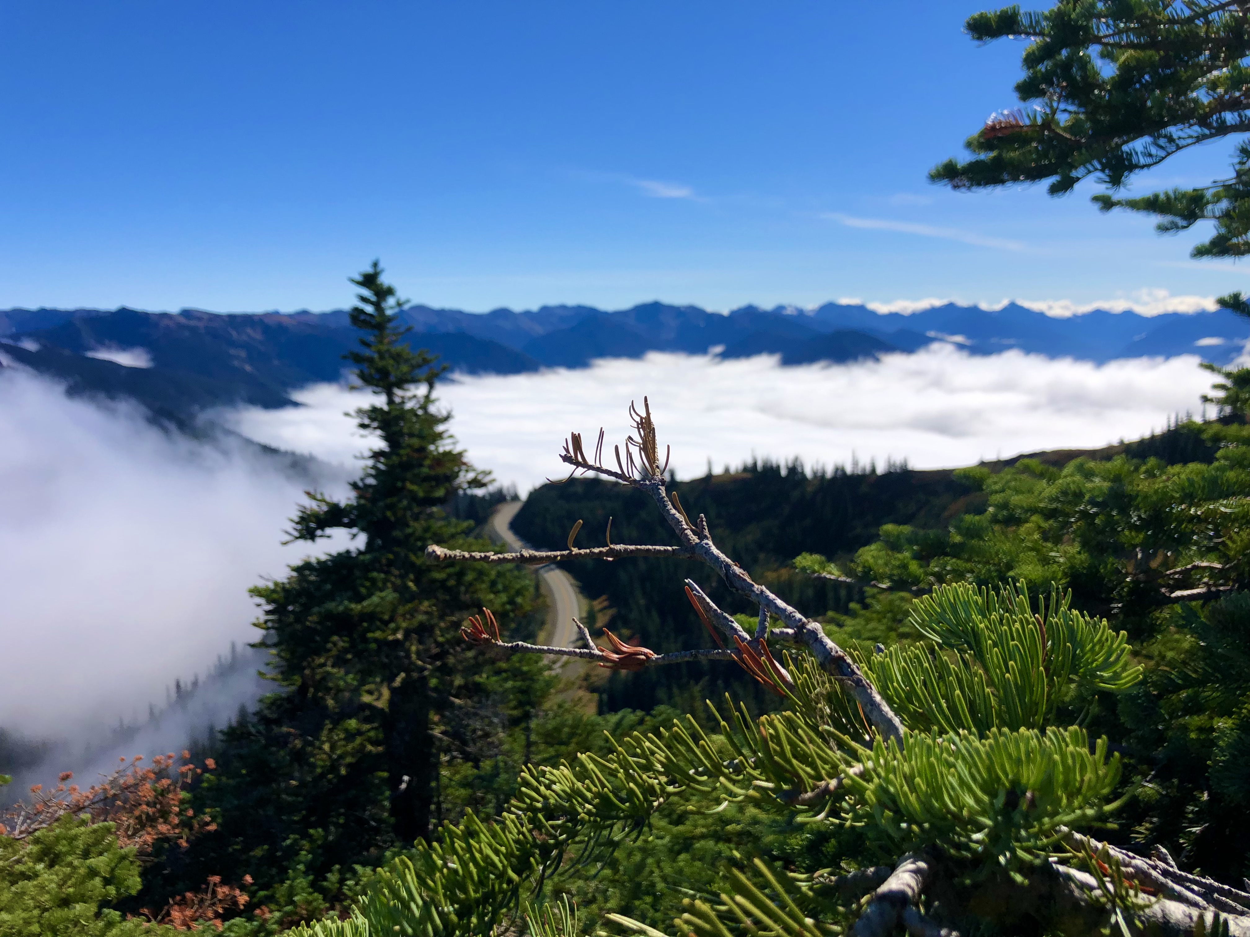
Within the last quarter mile of the drive, we broke through the clouds into bright sunshine and clear blue skies. To the southwest, we could see Mount Olympus and Blue Glacier, along with several other peaks in the Olympic Range. To the north we could see into Canada and Vancouver Island. The surrounding mountains seemed to be floating on a thick layer of white clouds below us.


At just over 5200 feet of elevation, Hurricane Ridge is one of only two areas in the U.S. where there is a ski area within a national park (the other is Badger Pass in Yosemite, where I’ve skied in the past), and you can see the ski lift equipment at the top of the ridge (although the lift looks like it hasn’t operated in a couple of years). We took a little hike, snapped some photos, and received a message from ATT that our International plan was available, thinking we were in Canada. We then jumped back into the car to go back down the mountain to see Lake Crescent and Marymere Falls, which are to the west of Port Angeles.


The short hike to Marymere Falls takes you through a thick forest of ferns, hardwoods and conifers with lots of hanging moss and strange fungal growths on fallen logs. Some of these trees are huge. And one tree even gave me a strange Winnie The Pooh experience. 


The waterfall is a ribbon-type fall that is about 90 feet tall. A series of slippery switch-backs and stairs takes you up to a good vantage point for viewing.


By this time, it was starting to get dark and we drove over to the Lake Crescent Lodge to check in for the night. It seems everyone else in the area had the same idea, because there was a large crowd of people waiting ahead of us. After a short wait, we got situated in our room. The lodge (built in 1916) is right on the edge of Lake Crescent, which is a 12 mile long lake created long ago by glaciation. The view from shore is quite nice.


We didn’t have dinner reservations at the lodge, and the restaurant was completely booked up for the evening. However, we were able to order from a limited take-out menu at the bar and we ate in our room.


There’s no wi-fi in the rooms, and the cell service is virtually non-existent, so we’re heading over to the main lobby later (where there is wi-fi) and try to upload today’s post.


NEXT: Rainforests and Lake Quinault

Saturday, October 2, 2021

Day 2 - Breakfast on the Fly, Military Outposts of Days Gone By, The Egg and I - October 2, 2021

 Karen did some online research and found us the perfect local breakfast spot: The Spruce Goose Cafe, at Jefferson County International Airport. Located just south of Port Townsend, the airfield caters to small planes, and the cafe serves as a fueling station for hungry pilots. On a Saturday morning, it was a busy place with customers flying and driving in to grab a bite to eat. The food was great and the price was right.


Every Saturday morning, April through October, Port Townsend has a farmer’s market in the historic uptown section of town. Perched on top of a hill overlooking Port Townsend Bay, in a neighborhood full of old Victorian-era homes, it’s a friendly affair. The stalls were full of outstanding produce brought in from farms located a few miles south of town. Karen was quite impressed by the vivid colors of the vegetables. We bought some homemade cookies and hopped back in the car to see Fort Worden Historic State Park.


Fort Worden sits at the top of what’s called the Quimper Peninsula in Port Townsend. It was built as an Army artillery base back at the beginning of the 20th century to serve as protection from any hostile enemy naval attack via the Strait of Juan de Fuca into Puget Sound. It’s now a Washington State Park, with hiking and biking trails that traverse the grounds. 


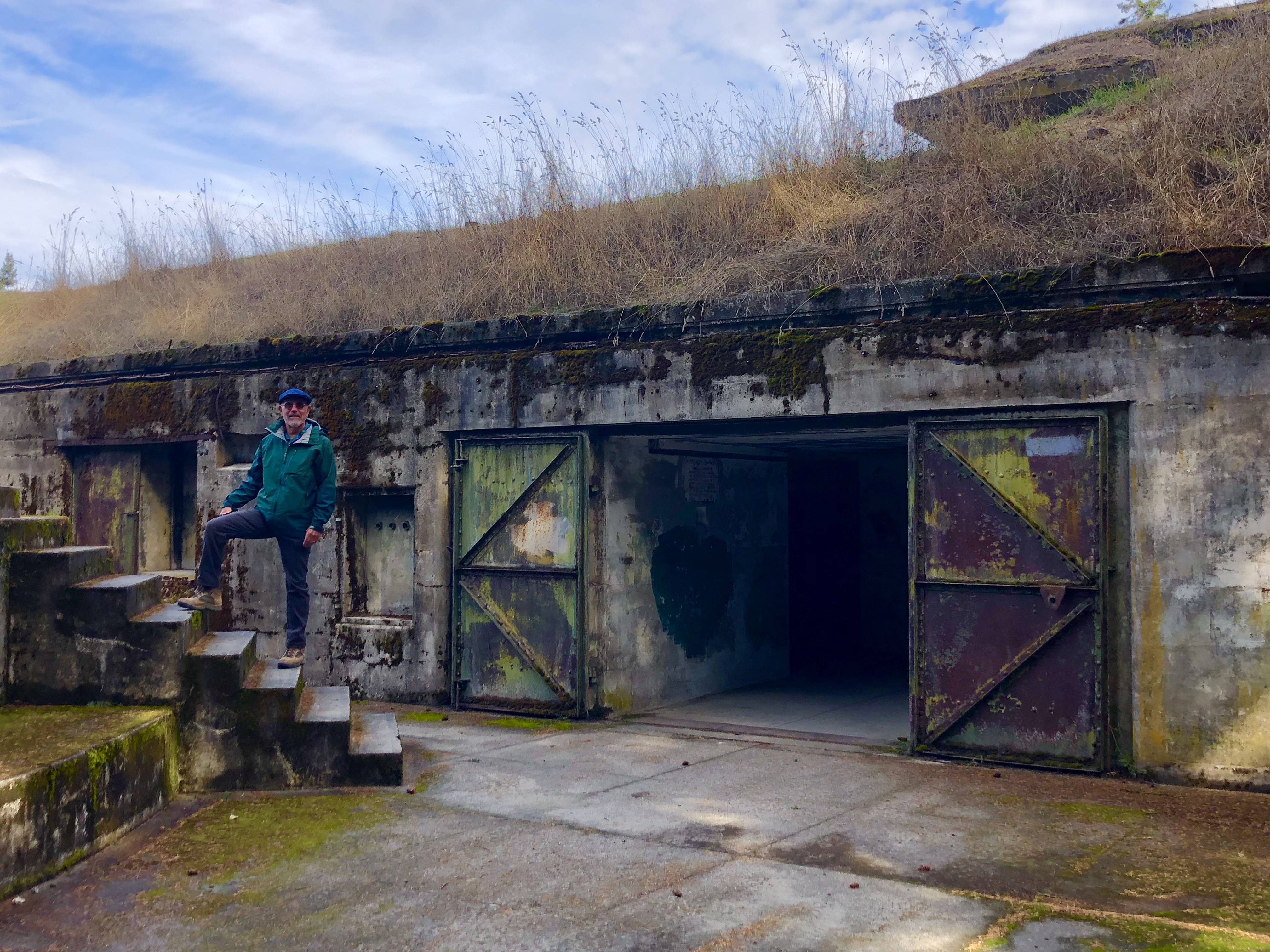
We walked along the beaches, watched sea lions cavorting just offshore, saw the historic Point Wilson lighthouse, and climbed on the remains of the huge concrete gun emplacements and bunkers that still exist up on the bluffs.


The state parks require day use fees of $10. We bought an annual pass for $30 since we expect to visit several more state parks during our trip. With that in mind, we headed west over to Indian Island and Marrowstone Island to visit a couple more state parks.


Fort Flagler State Park, like Fort Worden, was an early 20th century artillery base designed to work in concert with Fort Worden to protect against enemy invasion. Located at the far northern tip of Marrowstone Island, it’s now a destination for campers, hikers and bikers. It also uses the old military buildings for vacation rentals and business conferences. Wildlife freely roams the grounds.


We also stopped briefly at Mystery Bay State Park on Indian Island. This is a quiet little inlet that seems popular with kayakers and small boats.


Passing back through Port Hadlock, we saw a promising burger joint, but it was too late in the day for lunch. We stopped at a local grocery store to get stuff for picnic lunches, and went across the street to an equipment rental/Stihl Tool retailer/sporting goods shop to get a styrofoam cooler to store our road trip snacks.


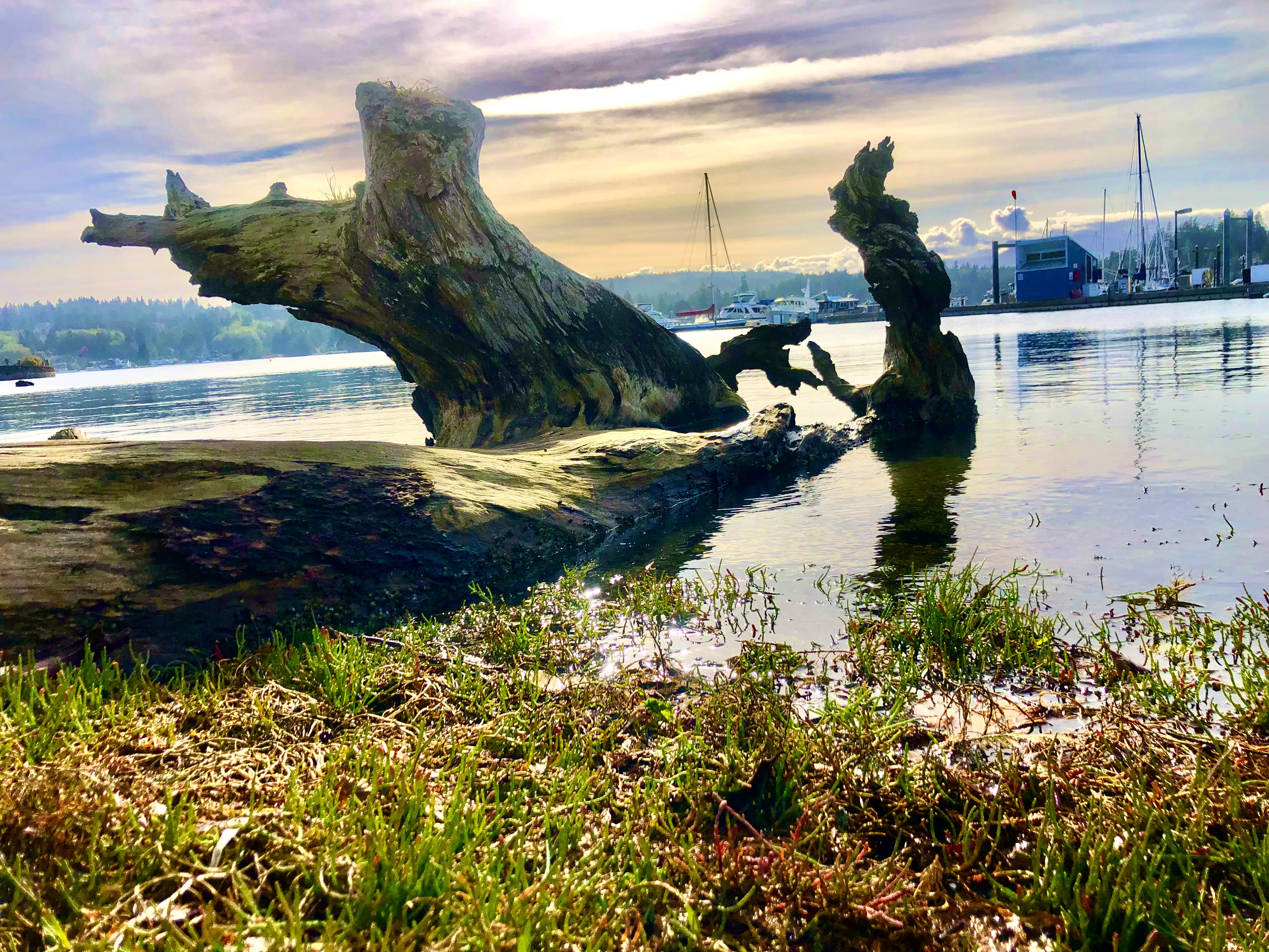
For dinner, Karen found us a local eatery in the Port Hadlock marina. The Ajax Cafe supposedly had a reputation as a rowdy hangout in the pre-COVID days. We found it to now be a quiet place. The vibe was sort of mild-hipster-meets-old-hippie-parental-types-for-al fresco dining. It was a nice way to wind down after a day in the fresh northwest air.


Having seen ‘Finnriver Cider’ for sale at the farmer’s market, and after having a bottle of it with dinner, I had to see if I could get some to have on hand for our next couple of weeks of travel. As it turns out, the cidery was located less than 2 miles away in nearby Chimacum.


We got there and showed our proof of vaccination and identification (all the bars and restaurants up here require this for admitance to indoor dining) and reviewed the sizeable collection of ciders that are made on site. The place was hopping tonight with lots of people dining, and families with small children running around the sprawling cider gardens. Now we have a supply of cider (Black Currant, Ginger, and Black Currant/Lavender) to keep in our mobile cooler for evening refreshments.


Our route back to Port Ludlow tonight took us along Egg and I Road for several miles. For those of you old enough to remember (or, for those of you who like to watch old-time movies) you may remember Fred MacMurray and Claudette Colbert in the movie loosely based on a memoir by Betty MacDonald. MacDonald based her book on her experiences living on a chicken farm in Chimacum. The book and film also led to the spin-off series of Ma and Pa Kettle movies. There’s nothing like country living!


NEXT: Port Angeles and Introduction to Olympic National Park

Friday, October 1, 2021

Washington State Road Trip - Day 1 - October 1, 2021


Our 19 day road trip began this morning with an early wake-up call in order to get to OC Airport in time for our flight to Seattle. Karen’s brother, Mike, graciously agreed to stay at our house while we’re gone, and he also dropped us off at the airport.

Since we’re expecting cooler and wetter weather than we’ve had in several months, we’re taking more clothing than we usually do. Our usual combination of Karen’s carry-on roller board and my large duffel bag just couldn’t handle the job. So, we pulled out a huge purple suitcase we had stored in the garage (thanks, Dad and Muriel!) to see if we could get everything packed.


After tossing in boots, hiking poles, coats and rain gear, we managed to get everything we needed into a total of three suitcases - one very large, and two small ones. We weighed the packed purple beast and it came in at just over 48 pounds.


When we checked the bags at the airport this morning, the purple bag had somehow gained some weight and was now coming in at around 52 pounds! The Alaska Airlines ticketing agent sternly told us that we’d exceeded the 50 pound limit, but she also said she would not charge us extra, just as long as we promised to be more mindful packers in future. Duly warned, we got on the airplane and went to Seattle.


One thing leads to another, so when we got to the rental car counter in Seattle, we decided to get a car that had enough trunk space for our baggage. Maybe next trip we should ship our stuff ahead on a cargo plane?


We had a leisurely drive south toward Tacoma and across the Tacoma Narrows Bridge (the site of a rather unfortunate engineering failure in 1940 four months after the original bridge was built), then north onto the Kitsap Peninsula. 


On today’s drive there was only one instance where the driver did not follow the navigator’s instructions. In fairness, the traffic circles in the Gig Harbor area have confusing signs with circles and arrows and spaghetti-like iconography which inevitably lead to some minor misdirection - that’s my story and I’m sticking to it.


Our final stop for today is the Port Ludlow Inn and Resort. 


Port Ludlow started out as a sawmill town in the 19th century and then went bust by the early 20th century. It has now become a resort town and marina for the well-heeled citizens of the greater Seattle area. We’ll be here tonight and tomorrow night.


NEXT:  Farmer’s Market in Port Townsend and other local exploration.